After three named storms in a week - Dudley, Eunice and Franklin - the wind subsided and the sun came out. Yesterday, it was time (3 pm, 21/2/22) to get some fresh air with a walk down to the River Wye. Rain in mid-Wales, where the source of the River Wye lies, takes 24-48 hours to work its way downstream to Hereford. If there is lots of rain in mid-Wales, then Hereford is susceptible to flooding.
Trying to find out how much rain had fallen in mid-Wales proved more difficult than I expected. I found this newspaper report saying 150 mm (6 inches) had fallen in upland Wales which had led to severe flooding along the River Severn. Eventually, I found a weather station (on the Davis Weatherlink network) at Rhyader that showed 203.2 mm (8 inches) of rain over the period of the three storms. The average rainfall in Rhyader is 100 mm (4 inches) for the whole of February!
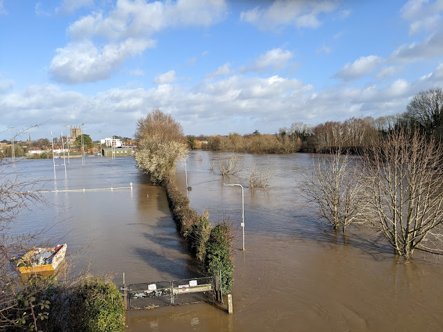
This photo was taken from the Hunderton Bridge on the Great Western Way looking towards the city. The river level was 5.2 metres (normal range 0.1 metre to 3.30 metres) and still rising, reaching its maximum (5.38 metres) about 6 hours later.
I guess there will be no rugby played this weekend at Hereford RFC...
...and fortunately, it is half-term for Hereford Cathedral School as the playing fields are under water...
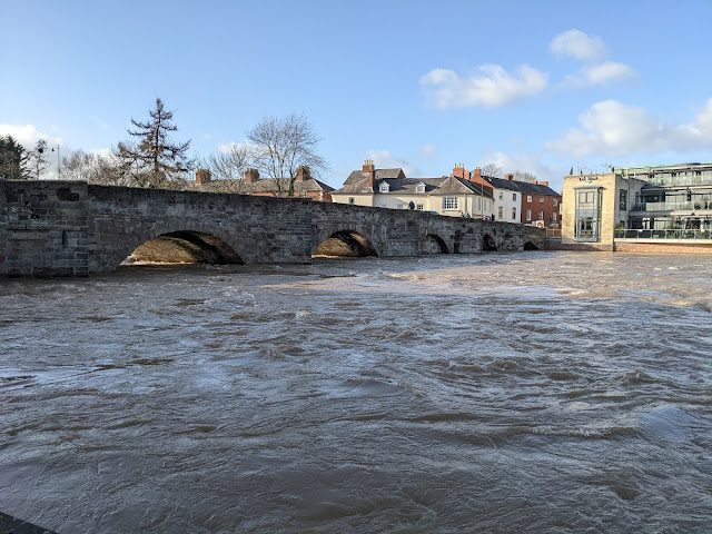
...the old
Wye Bridge (built
15th Century, rebuilt/widened
17th Century, grade 1 listed) was temporarily
closed at peak flood levels but lives to tell another day...
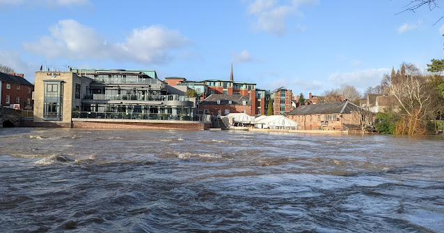
...while
De Koffie Pot (centre-right), one of our favourite eating and meeting places, just about avoided the flood water unlike 2 years ago; the benefits of some extra flood barriers clearly paid off...
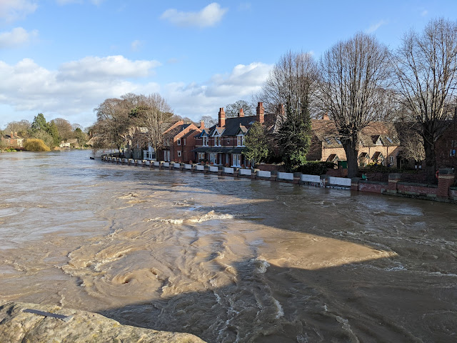
...meanwhile, this picture taken from the old Wye Bridge shows the flood barriers in place protecting the houses and businesses alongside the river...
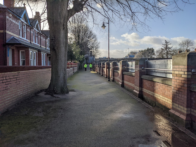
...with this view from the other side of the flood barriers showing what a good job they do. The Environment Agency still had people (yellow jackets) and equipment on site as the peak flood level was still a few hours off...
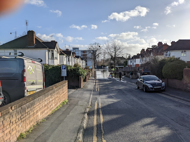
... and finally, on my way home, I took this photo of Greyfriars Avenue which runs down to the river and
Hereford Rowing Club...
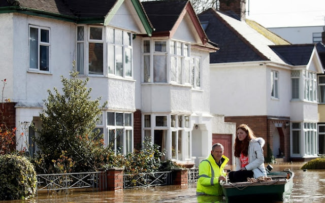
Two years ago, this road and its houses were severely flooded - it looked more like a canal as this picture from
The Telegraph shows...
February 2020 had the highest flood levels (6.1 metres) ever recorded at Hereford Bridge Station due to a combination of
Storm Dennis and exceptional local precipitation (100 mm, or nearly 4 inches, in 24 hours). This year, local precipitation was modest (26.8 mm over 3 days) which certainly helped.
Thankfully, as I post this, the floods are receding and levels are already below 4 metres.


0 comments:
Post a Comment